
Public Sources Around Five Corners Neighbors
No official source identified in the research gives a complete block-by-block roster. The useful sources instead describe land, boundaries, records, and public community contacts. This coverage table keeps each source tied to the limited block fact it can establish.
| Source | What It Shows About a Block | Access |
|---|---|---|
| MapsOnline taxlots and aerials | Parcel geometry, shared edges, roads, structures, and site patterns | Public GIS; aerial date varies |
| Property Information Center | Parcel ID, situs, legal description, and linked public tabs | Public address or parcel search |
| County neighborhood directory | Association point, boundary, and public contact route | Address search and map; not a member list |
| Subdivision, plat, and permit layers | Lot relationships, nearby projects, and public case points | MapsOnline, Auditor, PIC, or request |
| CCHM maps and aerials | Older landscape and neighborhood context | Electronic resources; research access currently limited |
A parcel card describes a taxlot and its public administrative record. An Auditor instrument identifies indexed parties to a filing. A voter result confirms a registration record for a known person. None is a household census, and an association contact is not proof that every nearby parcel belongs to that group.
Walk the Five Corners Block in MapsOnline
Clark County's MapsOnline combines a Find Parcel control with an Identify tool. Find the known address by tax parcel, house number, or street address, select the correct result, and let the map zoom to that lot. Then use Identify on the active layer to read the target and each adjoining taxlot.
- Save the target parcel number, situs address, and abbreviated legal description.
- Turn on taxlots and inspect parcels that share a side, rear line, or road frontage.
- Switch on subdivision, plat, aerial, neighborhood, city-limit, and ZIP layers one at a time.
- Check public permit or development-review symbols, recording the case number rather than inferring a person.
- Keep a dated list of parcel IDs and source layers so the map walk can be repeated.
The manifest's successful MapsOnline capture shows the public GIS interface used for this block method.
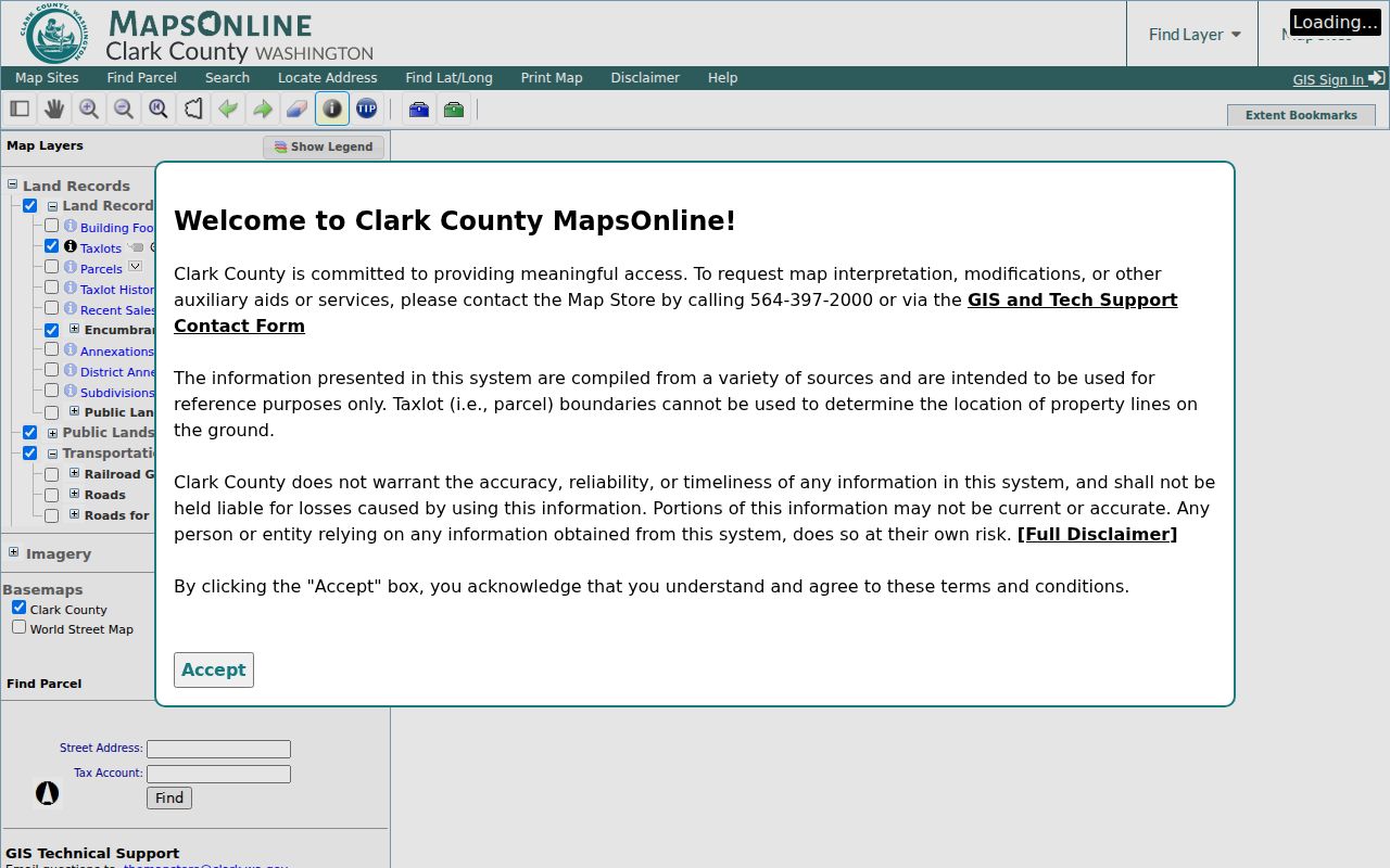
The viewer is strongest for spatial facts: adjacency, shared boundaries, streets, and layers. It does not identify present occupants.
Association Boundaries Near Five Corners Neighbors
The Clark County neighborhood-association directory supplies address searching, map points, published boundaries, and contact routes. Its own caveat matters: the directory is not an HOA or member roster, and its contacts are not authorized for solicitation.
| Association | Published boundary clues | Five Corners use |
|---|---|---|
| Maple Tree | NE 76th north, SR-503 east, Vancouver city boundary south, I-205 west | Direct Five Corners and annexation-area context |
| Sunnyside | NE 119th north; SR-503 or NE 117th east; NE 76th south; NE 94th, railroad, and NE 119th west | Direct historical annexation-area clue |
| Curtin Creek | Road segments around 119th, NE 94th or 95th, NE 78th or 76th, and I-205 or Andresen | Adjacent or overlapping lead that requires address checking |
| Sifton | NE 99th north, NE 152nd or Ward east, Fourth Plain south, SR-503 west | Nearby context; county page marks it inactive |
The successful neighborhood-directory capture records the public map and its boundary and contact context.
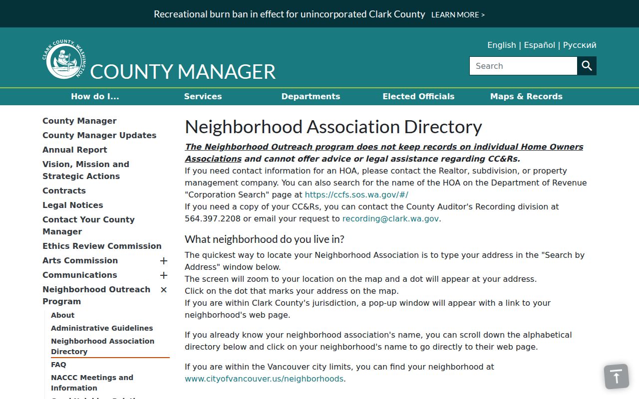
Use an exact address in the directory before naming an association, since familiar place names do not by themselves establish boundary membership.
Translate Five Corners Parcels into Block Context
The Property Information Center accepts a parcel, house number, or street address. Its card may show the PIN or tax account, status, situs address, abbreviated legal description, and tabs for buildings, taxes, Auditor documents, permits, and sales. Those fields let a researcher move from the map shape to a specific county record without claiming that the indexed owner is one of the current Five Corners neighbors.
The best text flow is: exact address → PIC parcel card → parcel ID and legal description → MapsOnline taxlots → adjoining parcel IDs → public permit, plat, or Auditor links. Compare a mailing address with the situs only as an administrative clue. For a whole road rather than the immediate radius, use the Five Corners street directory and its distinct by-address workflow.
- Taxlot
- The mapped parcel unit used for property administration.
- Situs address
- The location assigned to the parcel, which can differ from an owner's mailing address.
- Plat
- A recorded map that lays out lots, blocks, streets, or easements.
- Adjacency
- A spatial relationship between parcels, not evidence of a personal relationship.
A Civic Landmark for Five Corners Neighbors
Covington Neighborhood Park gives the block research a concrete public-space anchor. Clark County identifies it as being in the Maple Tree and Five Corners area and says it was completed in 2011. A park is not a people source, yet it can help orient an old place reference and distinguish the civic setting from a postal or Census label.
The same discipline applies to schools, utility areas, sewer areas, and fire districts named in the annexation blueprint. These service geographies can place a record in its administrative setting, but they are not interchangeable with neighborhood boundaries. Record the agency, layer, and date before using one to describe a Five Corners block.
Note: Public-space and service-district clues locate a block in context; they do not establish who lives around it.
Voter Records Do Not List All Five Corners Neighbors
VoteWA verifies a known voter from first name, last name, and birth date. It is not designed to enumerate a block. Washington's public voter subset can include name, address, jurisdiction, gender, birth year, voting record, registration date, and registration number, subject to statutory restrictions and protected-record exceptions.
A missing or different address can reflect a move, timing, a spelling issue, or lawful protection. Address Confidentiality Program substitute addresses and Protected Records Voter rules may withhold residential information. Never try to defeat those safeguards by combining unrelated sources. Clark Elections routes voter-data requests to the Secretary of State, and voter lists may not be used for advertisements, offers, or solicitations.
Official Block Records and Commercial Neighbor Tools
The two categories answer different questions and carry different proof value. Official sources identify their custodian, field definitions, and correction route. Commercial tools may merge old or licensed material without showing why a person was attached to an address.
| Feature | Official Clark or Washington source | Commercial category |
|---|---|---|
| Best use | Parcel, boundary, filing, permit, or known-voter fact | Unverified lead requiring source confirmation |
| Geographic precision | Named layer, taxlot, or agency jurisdiction | May blend postal and local labels |
| Correction | Route to the Assessor, Auditor, Elections, or other custodian | Provider-specific privacy or correction process |
| Main limit | Each record proves only its stated administrative fact | Source date and match logic may be unclear |
For Five Corners neighbors, build the finding from the map and the issuing office. Do not republish sensitive details merely because a source can be opened.
Privacy Limits for Five Corners Neighbors
Public parcel, deed, permit, and association records do not form an official list of all people on a block. A party on a deed may be a trustee, estate, lender, or organization. A tax mailing address can differ from the situs. Household members need not appear at all, and protected residential addresses can be lawfully absent or replaced.
Lawful use. Use block records for civic curiosity, property research, or reconnecting. Never use them to watch, threaten, harass, or expose a protected person.
Publish the least personal detail needed to support a claim. Keep the parcel number, case number, source URL, and retrieval date for audit purposes, but omit full birth dates, registration numbers, private contact details, and protected addresses.